Category:Royal Borough of Kensington and Chelsea
Jump to navigation
Jump to search
Boroughs of London: City of London · City of Westminster · Barking and Dagenham · Barnet · Bexley · Brent · Bromley · Camden · Croydon · Ealing · Enfield · Greenwich · Hackney · Hammersmith and Fulham · Haringey · Harrow · Havering · Hillingdon · Hounslow · Islington · Kensington and Chelsea · Kingston · Lambeth · Lewisham · Merton · Newham · Redbridge · Richmond · Southwark · Sutton · Tower Hamlets · Waltham Forest · Wandsworth
royal borough in the London Region in England    | |||||
| Upload media | |||||
| Pronunciation audio | |||||
|---|---|---|---|---|---|
| Instance of | |||||
| Location | Greater London, London, England | ||||
| Capital | |||||
| Legislative body |
| ||||
| Executive body |
| ||||
| Head of government |
| ||||
| Inception |
| ||||
| Population |
| ||||
| Area |
| ||||
| Replaces | |||||
| official website | |||||
 | |||||
Subcategories
This category has the following 22 subcategories, out of 22 total.
A
E
F
G
H
P
S
Media in category "Royal Borough of Kensington and Chelsea"
The following 200 files are in this category, out of 677 total.
(previous page) (next page)-

-
-
 "Marjon's", Fulham Road - geograph.org.uk - 6948677.jpg 1,600 × 1,216; 423 KB
-

-
 "Tardis" Police telephone box - geograph.org.uk - 2388902.jpg 2,736 × 3,648; 2.04 MB
-
 "Tent in the park" pavilion by Design Museum - geograph.org.uk - 5266150.jpg 3,648 × 2,736; 3.49 MB
-
 'Beans' on an Indian Bean Tree, Brompton Cemetery - geograph.org.uk - 6943330.jpg 1,245 × 1,600; 654 KB
-
.jpg/120px-Image_taken_from_page_36_of_%27Old_and_New_London%2C_etc%27_(11191197814).jpg) Image taken from page 36 of 'Old and New London, etc' (11191197814).jpg 1,892 × 1,600; 1.19 MB
Image taken from page 36 of 'Old and New London, etc' (11191197814).jpg 1,892 × 1,600; 1.19 MB
-
_Block_on_Oxford_Gardens%2C_London_-_geograph.org.uk_-_6433239.jpg/120px-1960%27s_(%5E)_Block_on_Oxford_Gardens%2C_London_-_geograph.org.uk_-_6433239.jpg) 1960's (^) Block on Oxford Gardens, London - geograph.org.uk - 6433239.jpg 3,264 × 2,448; 2.08 MB
1960's (^) Block on Oxford Gardens, London - geograph.org.uk - 6433239.jpg 3,264 × 2,448; 2.08 MB
-
 34 Tite Street - geograph.org.uk - 7145356.jpg 4,753 × 3,168; 3.37 MB
-
 A Colourful Bridge - geograph.org.uk - 3925308.jpg 1,600 × 1,200; 445 KB
-
 A curious angel with one wing in Brompton Cemetery - geograph.org.uk - 7033653.jpg 5,184 × 3,888; 6.82 MB
-
 A Dutch motor-barge at Kensal Town - geograph.org.uk - 7011475.jpg 1,600 × 1,200; 437 KB
-
 A line-up of buses – 1968 - geograph.org.uk - 6881807.jpg 1,280 × 780; 293 KB
-

-

-
 A view of Harrods on Brompton Road - geograph.org.uk - 7034667.jpg 1,241 × 1,189; 348 KB
-
 A Wet Day in Chelsea - geograph.org.uk - 3408584.jpg 3,888 × 2,592; 2.6 MB
-
 A3220 - geograph.org.uk - 7036033.jpg 1,024 × 684; 206 KB
-
 A3220 - geograph.org.uk - 7036036.jpg 1,024 × 684; 215 KB
-
 A4204 - geograph.org.uk - 7036277.jpg 1,024 × 684; 177 KB
-
 Abingdon Villas, Kensington W8 - geograph.org.uk - 6944295.jpg 1,600 × 1,194; 370 KB
-
 Above the District Line - geograph.org.uk - 3638299.jpg 427 × 640; 121 KB
-
 Alder on the Paddington Branch - geograph.org.uk - 3932343.jpg 2,000 × 1,568; 740 KB
-
 Algae Meadow, Exhibition Road, South Kensington - geograph.org.uk - 6954308.jpg 2,592 × 1,936; 1.91 MB
-
-
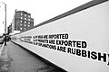 All my explanations are rubbish - geograph.org.uk - 4754734.jpg 1,600 × 1,066; 204 KB
-
 Alleyway to Ladbroke Grove - geograph.org.uk - 3774451.jpg 4,288 × 3,216; 4.89 MB
-
_in_Brompton_Cemetery_-_geograph.org.uk_-_6943332.jpg/90px-An_Indian_Bean_Tree_(Catalpa_bignonioides)_in_Brompton_Cemetery_-_geograph.org.uk_-_6943332.jpg)
-
 An Indian Bean Tree in Brompton Cemetery - geograph.org.uk - 6934674.jpg 1,161 × 1,600; 558 KB
-
 Approaching the gasworks near Kensal Green - geograph.org.uk - 4849290.jpg 1,600 × 1,200; 357 KB
-
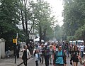 Arriving at the Carnival - geograph.org.uk - 3621519.jpg 640 × 498; 108 KB
-
 Artwork under Carlton Bridge - geograph.org.uk - 2421721.jpg 800 × 600; 429 KB
-
 At the V^A - geograph.org.uk - 7150544.jpg 4,497 × 3,264; 3.57 MB
-
 At the V^A Café - geograph.org.uk - 7147764.jpg 4,672 × 3,063; 2.96 MB
-
 Autumn at Chelsea Embankment - geograph.org.uk - 7032660.jpg 1,197 × 1,600; 610 KB
-
 Autumn in Brompton Cemetery - geograph.org.uk - 6658233.jpg 3,200 × 2,400; 3.19 MB
-
 Babylon Roof Gardens Restaurant - geograph.org.uk - 5244775.jpg 5,800 × 3,866; 2.53 MB
-
 Backing onto the Grand Union Canal - geograph.org.uk - 3815756.jpg 640 × 430; 70 KB
-
 Backing onto the Grand Union Canal - geograph.org.uk - 3815762.jpg 640 × 430; 76 KB
-
 Bank in woodland to conserve rainwater, Holland Park - geograph.org.uk - 5807948.jpg 2,736 × 2,049; 3.26 MB
-
 Barge in Chelsea Reach - geograph.org.uk - 5375486.jpg 640 × 357; 72 KB
-
 Barkston Gardens, SW5 - geograph.org.uk - 6448692.jpg 1,024 × 768; 493 KB
-
 Basin by the Grand Union Canal - geograph.org.uk - 3815733.jpg 640 × 430; 58 KB
-
 Battersea Bridge - geograph.org.uk - 7066676.jpg 1,819 × 1,326; 459 KB
-
 Battersea Bridge - geograph.org.uk - 7157785.jpg 3,000 × 2,250; 5.05 MB
-
.jpg/120px-Bears_Den%2C_Tabernacle%2C_London_(32508141377).jpg) Bears Den, Tabernacle, London (32508141377).jpg 3,072 × 1,728; 1,017 KB
Bears Den, Tabernacle, London (32508141377).jpg 3,072 × 1,728; 1,017 KB
-
 Black Lion Gate - geograph.org.uk - 7036298.jpg 1,024 × 684; 284 KB
-
 Blossom and peacock in the Kyoto Garden - geograph.org.uk - 6131474.jpg 4,000 × 3,000; 4.78 MB
-
 Bluebell - narrowboat on Paddington Arm, Grand Union Canal - geograph.org.uk - 4461317.jpg 3,648 × 2,736; 3.94 MB
-
 Boats parked by Battersea Bridge - geograph.org.uk - 2099520.jpg 640 × 430; 119 KB
-
 Botanical adornment in Brompton Cemetery - geograph.org.uk - 7033640.jpg 3,660 × 4,832; 6.11 MB
-
 BP Olympics billboard - geograph.org.uk - 7072493.jpg 2,424 × 1,747; 767 KB
-
 Bridge 4 Paddington Arm - Ladbroke Grove west access - geograph.org.uk - 2735520.jpg 3,648 × 2,736; 2.88 MB
-
 Brompton , Lennox Gardens - geograph.org.uk - 6164951.jpg 994 × 1,024; 901 KB
-
 Brompton Cemetery - geograph.org.uk - 7157460.jpg 2,250 × 3,000; 7.48 MB
-
 Brompton Cemetery - geograph.org.uk - 7157708.jpg 2,250 × 3,000; 7.13 MB
-
 Brompton Cemetery - geograph.org.uk - 7157735.jpg 3,000 × 2,250; 5.94 MB
-
 Brompton Cemetery, a view towards the colonnades - geograph.org.uk - 6932927.jpg 1,200 × 1,600; 449 KB
-
 Brompton Cemetery, light and shade in a colonnade - geograph.org.uk - 6943696.jpg 1,200 × 1,600; 333 KB
-

-
 Builder's yard, West Kilburn - geograph.org.uk - 2421788.jpg 800 × 600; 434 KB
-
 Building by the Grand Union Canal - geograph.org.uk - 3815742.jpg 640 × 430; 67 KB
-
 Campden Hill Rd - geograph.org.uk - 7036258.jpg 1,024 × 684; 176 KB
-
 Campden Houses No.2 - geograph.org.uk - 5530345.jpg 425 × 640; 87 KB
-
 Campden Houses No.3 - geograph.org.uk - 5530342.jpg 426 × 640; 83 KB
-
 Campden Houses No.5 - geograph.org.uk - 5530347.jpg 425 × 640; 85 KB
-
 Campden Houses No.6 - geograph.org.uk - 5530352.jpg 426 × 640; 84 KB
-
 Campden Houses No.7 - geograph.org.uk - 5530357.jpg 425 × 640; 84 KB
-
 Canal boat on The Grand Union Canal - geograph.org.uk - 6385221.jpg 5,456 × 3,632; 4.02 MB
-
 Canal bridge at Kensal Green - geograph.org.uk - 2387603.jpg 1,024 × 768; 384 KB
-
 Canalside Apartments - geograph.org.uk - 3953466.jpg 3,744 × 2,460; 3.12 MB
-

-
 Canalside properties at Kensal Town - geograph.org.uk - 4849299.jpg 1,600 × 1,200; 327 KB
-
 Caroline on the Paddington Branch - geograph.org.uk - 3932247.jpg 2,000 × 1,545; 708 KB
-
 Central Courtyard - geograph.org.uk - 7147757.jpg 4,158 × 2,787; 3.1 MB
-
 Central courtyard of the Victoria ^ Albert Museum - geograph.org.uk - 6853427.jpg 2,592 × 1,936; 2.24 MB
-
 Cheese stall, Chelsea - geograph.org.uk - 3772050.jpg 4,663 × 3,320; 6.11 MB
-
 Chelsea , Donne Place - geograph.org.uk - 6163757.jpg 829 × 1,024; 602 KB
-
 Chelsea , Sutton Dwellings - geograph.org.uk - 6164358.jpg 776 × 1,024; 826 KB
-
 Chelsea , Sutton Dwellings - geograph.org.uk - 6164368.jpg 881 × 1,024; 818 KB
-
 Chelsea , Sutton Dwellings - geograph.org.uk - 6164374.jpg 779 × 1,024; 524 KB
-
 Chelsea , Walton House - geograph.org.uk - 6164313.jpg 789 × 1,024; 992 KB
-
 Chelsea , Walton House - geograph.org.uk - 6164329.jpg 652 × 1,024; 620 KB
-
 Chelsea Bridge and beyond - geograph.org.uk - 7145395.jpg 3,102 × 2,256; 1.58 MB
-
 Chelsea Creek - geograph.org.uk - 5289920.jpg 640 × 426; 68 KB
-
 Chelsea Creek - geograph.org.uk - 5308298.jpg 1,600 × 1,200; 547 KB
-
 Chelsea Creek - geograph.org.uk - 6959293.jpg 640 × 303; 68 KB
-
 Chelsea Creek at high tide - geograph.org.uk - 6943011.jpg 1,166 × 1,600; 419 KB
-
 Chelsea Creek Warehouse - geograph.org.uk - 4334722.jpg 640 × 480; 38 KB
-
 Chelsea Embankment - geograph.org.uk - 2322527.jpg 640 × 288; 50 KB
-
 Chelsea Embankment seen from Battersea Park - geograph.org.uk - 6352753.jpg 4,885 × 2,479; 2.71 MB
-
 Chelsea Flower Show - geograph.org.uk - 7168066.jpg 2,048 × 1,536; 1.19 MB
-
 Chelsea houseboat village - geograph.org.uk - 2873685.jpg 4,000 × 3,000; 4.19 MB
-
 Chelsea houseboat village - geograph.org.uk - 2873696.jpg 4,000 × 3,000; 4.12 MB
-
 Chelsea houseboats - geograph.org.uk - 4602937.jpg 1,024 × 683; 166 KB
-
 Chelsea Houses - geograph.org.uk - 7171378.jpg 3,257 × 2,989; 1.54 MB
-
 Chelsea shops - geograph.org.uk - 5663230.jpg 3,188 × 2,391; 1.34 MB
-
 Chelsea waterfront - geograph.org.uk - 4704491.jpg 5,841 × 3,894; 2.44 MB
-
 Chelsea, green - geograph.org.uk - 5087142.jpg 1,024 × 768; 315 KB
-
 Chelsea, moorings - geograph.org.uk - 5085597.jpg 1,024 × 740; 185 KB
-
 Chelsea, moorings - geograph.org.uk - 5085662.jpg 1,024 × 768; 156 KB
-
 Church of St James - geograph.org.uk - 7036070.jpg 1,024 × 684; 276 KB
-
 Clanricarde Gardens - geograph.org.uk - 7036280.jpg 1,024 × 684; 254 KB
-

-
 Cliveden Place - geograph.org.uk - 4194414.jpg 640 × 430; 81 KB
-
 Close up of the Ducrow Sepulchre, Kensal Green Cemetery - geograph.org.uk - 7133616.jpg 1,920 × 1,440; 1.12 MB
-
 Coat of arms of the Royal Borough of Kensington and Chelsea.svg 1,121 × 977; 2.33 MB
-
-
 Comffortable Fitflop - geograph.org.uk - 3805682.jpg 640 × 480; 105 KB
-
 Coming to a point - geograph.org.uk - 2826715.jpg 1,024 × 768; 135 KB
-
 Comptoir Libanais - geograph.org.uk - 4516855.jpg 640 × 481; 117 KB
-
 Courtyard garden, Museum of Brands - geograph.org.uk - 5012414.jpg 2,565 × 3,403; 2.73 MB
-
 Cranley Gardens - geograph.org.uk - 7064146.jpg 2,195 × 1,758; 990 KB
-
 Crosby Hall - geograph.org.uk - 5290058.jpg 640 × 426; 76 KB
-
 Crosby Hall - geograph.org.uk - 5290062.jpg 640 × 426; 76 KB
-
 Cylindrical floating storage container on canal - geograph.org.uk - 5048328.jpg 2,304 × 1,728; 2.44 MB
-
 Decorative panel, South Kensington - geograph.org.uk - 4979909.jpg 1,616 × 1,156; 357 KB
-
 Detail of a Dutch motor-barge - the port lee-board - geograph.org.uk - 7011496.jpg 1,600 × 1,122; 434 KB
-
 Detail of Emmeline Pankhurst's gravestone. - geograph.org.uk - 7033537.jpg 4,558 × 3,061; 3.59 MB
-

-

-
 Earls Court Two - geograph.org.uk - 6448868.jpg 1,024 × 768; 408 KB
-
 Elephant, Chelsea Flower Show - geograph.org.uk - 4969736.jpg 3,000 × 4,000; 3.08 MB
-
 Elgin Crescent - geograph.org.uk - 7074520.jpg 838 × 809; 191 KB
-
 Ellesmere - narrowboat on Paddington Arm, Grand Union Canal - geograph.org.uk - 4460925.jpg 3,648 × 2,736; 3.55 MB
-
 Elm Park Gardens, Chelsea - geograph.org.uk - 7027353.jpg 1,148 × 1,600; 326 KB
-
 Emma Jane - narrowboat on Paddington Arm, Grand Union Canal - geograph.org.uk - 4461250.jpg 3,648 × 2,736; 3.65 MB
-
 Emu on the Paddington Branch - geograph.org.uk - 3932299.jpg 2,000 × 1,756; 729 KB
-
 Evelyn Gardens - geograph.org.uk - 7064150.jpg 2,521 × 1,784; 1.02 MB
-
 Evelyn Gardens - geograph.org.uk - 7064153.jpg 3,372 × 2,621; 1.93 MB
-
 Evelyn Gardens - geograph.org.uk - 7072484.jpg 1,615 × 2,148; 555 KB
-
 Evelyn Gardens - geograph.org.uk - 7107643.jpg 2,869 × 4,320; 2.14 MB
-
 Exhibition Road - geograph.org.uk - 6969715.jpg 1,024 × 561; 214 KB
-
 Fat squirrel posing on a gravestone - geograph.org.uk - 7033644.jpg 4,993 × 3,758; 2.65 MB
-
 Feeding the Squirrel, Holland Park - geograph.org.uk - 5695992.jpg 5,312 × 2,988; 5.2 MB
-
 Fired Earth, Notting Hill - geograph.org.uk - 4994221.jpg 640 × 480; 117 KB
-
 Flagpoles outside former Commonwealth Institute - geograph.org.uk - 6448246.jpg 1,024 × 684; 524 KB
-
 Flats by the Thames in Battersea - geograph.org.uk - 5812379.jpg 2,048 × 1,536; 1.5 MB
-
 Flats overlooking Grand Union Canal - geograph.org.uk - 6385167.jpg 5,456 × 3,632; 2.04 MB
-
 Flats reflected in the Grand Union Canal - geograph.org.uk - 3155044.jpg 1,024 × 768; 1.27 MB
-
 Flats, Kensal Green - geograph.org.uk - 4905716.jpg 640 × 426; 90 KB
-
 Flats, Kensal Town - geograph.org.uk - 4905710.jpg 640 × 426; 73 KB
-

-

-

-
 Footbridge over canal - geograph.org.uk - 4742666.jpg 640 × 480; 130 KB
-

-

-
 Footbridge over the Paddington Arm - geograph.org.uk - 5492913.jpg 4,000 × 3,000; 2.95 MB
-
 Footbridge over the Paddington Arm of the Grand Union Canal - geograph.org.uk - 3769281.jpg 4,000 × 3,000; 4.04 MB
-
 Former lifeboat on the Grand Union Canal - geograph.org.uk - 6385525.jpg 5,456 × 3,632; 2.76 MB
-
 Fountain, Holland Park Avenue - geograph.org.uk - 7036044.jpg 684 × 1,024; 272 KB
-
.jpeg/80px-Fötus_Siebter_Monat_(193364921).jpeg) Fötus Siebter Monat (193364921).jpeg 1,365 × 2,048; 654 KB
Fötus Siebter Monat (193364921).jpeg 1,365 × 2,048; 654 KB
-
 Garden Corner - geograph.org.uk - 5295724.jpg 454 × 640; 103 KB
-
 Garden of Edible and Useful Plants - geograph.org.uk - 2971849.jpg 2,272 × 1,704; 2.67 MB
-
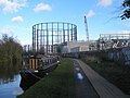
 Gas holder - geograph.org.uk - 5201451.jpg 640 × 389; 65 KB
-
 Gasholder - geograph.org.uk - 4905626.jpg 640 × 425; 82 KB
-
 Gasholder - geograph.org.uk - 6786779.jpg 1,024 × 684; 183 KB
-
 Gasholder by the Grand Union Canal - geograph.org.uk - 3815689.jpg 640 × 430; 68 KB
-
 Gasholder, Kensal Gas Works - geograph.org.uk - 5594460.jpg 640 × 445; 75 KB
-
 Gasholder, Kensal Gasworks - geograph.org.uk - 5652445.jpg 640 × 426; 70 KB
-
 Gasholder, Kensal Gasworks - geograph.org.uk - 5652446.jpg 640 × 425; 70 KB
-
 Gasholders by the Grand Union Canal - geograph.org.uk - 3815706.jpg 640 × 430; 47 KB
-
 Gasometer from the train, Kensal Green - geograph.org.uk - 3529272.jpg 1,600 × 1,064; 459 KB
-
 Gasometers near railway lines - geograph.org.uk - 4732798.jpg 800 × 541; 116 KB
-
 Gasworks view - geograph.org.uk - 2268220.jpg 640 × 480; 88 KB
-
 Gateways, Kensington Palace Gardens - geograph.org.uk - 7036284.jpg 1,024 × 684; 235 KB
-
 Gateways, Kensington Palace Gardens - geograph.org.uk - 7036285.jpg 1,024 × 684; 243 KB
-
 Getting lunch ready - geograph.org.uk - 3621529.jpg 640 × 480; 98 KB
-
 Glass dome at Chelsea Harbour - geograph.org.uk - 4220652.jpg 480 × 640; 171 KB
-

-
 Grand Union - geograph.org.uk - 6134849.jpg 3,648 × 2,432; 1.67 MB
-
 Grand Union Canal - geograph.org.uk - 6385516.jpg 5,456 × 3,632; 2.65 MB
-
 Grand Union Canal - geograph.org.uk - 6385517.jpg 5,456 × 3,632; 2.49 MB
-
 Grand Union Canal at Kensal Town - geograph.org.uk - 4646371.jpg 640 × 480; 81 KB
-
 Grand Union Canal at Kensal Town - geograph.org.uk - 4646379.jpg 640 × 480; 78 KB
-
 Grand Union Canal at Kensal Town - geograph.org.uk - 4647754.jpg 640 × 480; 81 KB
-
 Grand Union Canal at Ladbroke Grove - geograph.org.uk - 6385312.jpg 5,456 × 3,632; 2.25 MB
-
 Grand Union Canal at Ladbroke Grove - geograph.org.uk - 6385314.jpg 5,456 × 3,632; 2.18 MB
-
 Grand Union Canal near Kensal gasworks - geograph.org.uk - 5523375.jpg 4,000 × 3,000; 4.02 MB
-
 Grand Union Canal near Kensal gasworks - geograph.org.uk - 5523380.jpg 4,000 × 3,000; 3.64 MB
-
 Grand Union Canal near Kensal Town - geograph.org.uk - 5523354.jpg 4,000 × 3,000; 3.47 MB
-
 Grand Union Canal near Kensal Town - geograph.org.uk - 5523358.jpg 4,000 × 3,000; 3.08 MB
-
 Grand Union Canal near Kensal Town - geograph.org.uk - 5523363.jpg 4,000 × 3,000; 3.48 MB
-
 Grand Union Canal near Kensal Town - geograph.org.uk - 5523367.jpg 4,000 × 3,000; 4.39 MB
-
 Grand Union Canal near Ladbroke Grove - geograph.org.uk - 6385308.jpg 5,456 × 3,632; 2.2 MB
-
 Grand Union Canal near Ladbroke Grove - geograph.org.uk - 6385513.jpg 5,456 × 3,632; 3.02 MB
-
 Grand Union Canal towards Ladbroke Grove - geograph.org.uk - 6385204.jpg 5,456 × 3,632; 2.7 MB
-
 Grand Union Canal towards Ladbroke Grove - geograph.org.uk - 6385206.jpg 5,456 × 3,632; 2.74 MB
-
 Grand Union Canal towards Ladbroke Grove - geograph.org.uk - 6385212.jpg 5,456 × 3,632; 2.94 MB
-
 Grand Union Canal towards Ladbroke Grove - geograph.org.uk - 6385215.jpg 5,456 × 3,632; 2.77 MB
-
 Grand Union Canal towards Ladbroke Grove - geograph.org.uk - 6385230.jpg 5,456 × 3,632; 2.52 MB
-
 Grand Union Canal towards Ladbroke Grove - geograph.org.uk - 6385294.jpg 5,456 × 3,632; 2.97 MB
-
 Grand Union Canal towards Ladbroke Grove - geograph.org.uk - 6385297.jpg 5,456 × 3,632; 2.02 MB
-
 Grand Union Canal towards Ladbroke Grove - geograph.org.uk - 6385302.jpg 5,456 × 3,632; 3.15 MB
-
 Grand Union Canal towards Ladbroke Grove - geograph.org.uk - 6385305.jpg 5,456 × 3,632; 2.75 MB
-
 Grand Union Canal towards Mitre Bridge - geograph.org.uk - 6385519.jpg 5,456 × 3,632; 2.92 MB
-
 Grand Union Canal towards Mitre Bridge - geograph.org.uk - 6385522.jpg 5,456 × 3,632; 3.15 MB
-
 Grand Union Canal towards Mitre Bridge - geograph.org.uk - 6385523.jpg 5,456 × 3,632; 2.88 MB


.jpg)
_Block_on_Oxford_Gardens,_London_-_geograph.org.uk_-_6433239.jpg)


_in_Brompton_Cemetery_-_geograph.org.uk_-_6943332.jpg)


.jpg)


.jpeg)


