Category:Linguistic maps of the French language
Jump to navigation
Jump to search
Subcategories
This category has the following 4 subcategories, out of 4 total.
Media in category "Linguistic maps of the French language"
The following 27 files are in this category, out of 27 total.
-
18th c. Map of French Florida (8571302605).jpg 732 × 1,040; 221 KB
-
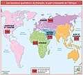
Amérique française.JPG 550 × 550; 37 KB
-
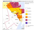
Arrondissement BHV.PNG 1,090 × 720; 40 KB
-
Comunidades lingüísticas de Bélgica.png 405 × 333; 8 KB
-
Distribution map of the French language in Europe (with Occitan).png 1,096 × 958; 160 KB
-
Distribution map of the French language in Europe.png 1,096 × 958; 696 KB
-
Fribourg français 2000.png 6,006 × 9,548; 3.39 MB
-
Jura francophone.png 8,824 × 13,360; 5.5 MB
-
Knowledge French EU map-fr.svg 1,212 × 1,242; 548 KB
-
Knowledge French EU map.png 1,218 × 1,245; 98 KB
-
Knowledge of French EU map.svg 1,212 × 1,242; 549 KB
-
Langues du Cameroun Carte.png 500 × 656; 71 KB
-
Les-Francophones-du-Nouveau-Brunswick.jpg 1,180 × 824; 609 KB
-
Louisiana French Immersion Parishes.png 638 × 517; 249 KB
-
Louisiane francophone.png 651 × 552; 206 KB
-
Missouri French Distribution.svg 185 × 149; 374 KB
-
Moncton FR maison 2016.png 12,974 × 10,788; 4.34 MB
-
Nation Française - Ethnisme.png 4,429 × 3,906; 949 KB
-
NativevsOfficial.png 6,300 × 6,300; 2.22 MB
-
NB % francophone 2011.png 11,725 × 11,477; 4.04 MB
-
Ontario Est FR 2016.png 10,630 × 5,882; 2.47 MB
-
Population speaking French at home in New England, percent by county.svg 487 × 467; 1.74 MB
-
Population speaking French at home in New England, sum by county.svg 487 × 467; 1.78 MB
-
Second Most Prevalent Languages in the US.svg 959 × 593; 74 KB
-
Sprachen deutsches reich 1900 französisch.png 363 × 315; 5 KB
.jpg/84px-18th_c._Map_of_French_Florida_(8571302605).jpg)


.png/120px-Distribution_map_of_the_French_language_in_Europe_(with_Occitan).png)


.svg/120px-Total_New_England_French-language_newspapers_of_by_municipality_(1838-1938).svg.png)